
Researchers from the A.A. Trofimuk Institute of Petroleum Geology and Geophysics SB RAS have investigated active fault zones in the high-mountainous part of Gorny Altai and in the estuary of Lena River (Yakutia) using structural geomorphology, paleoseismology, and electrical resistivity tomography (ERT) methods. The integrated works were carried out by the groups of scientists under the guidance of E.V. Deev D Sc (geol.-mineral.) and V.V. Olenchenko, PhD (geol.-mineral.).
- The ERT method, which is noteworthy for its being cost effective, is also a quick and straightforward method for interpreting and deep processing of measurement data. The method allows obtaining information on the geological structure, including that of active faults (i.e. potential source of seismic hazard), to a depth of up to 100 m, the researchers note. The IPGG SB RAS researchers tested the integrated methods during the study of the modern surface rupture zones of the 2003Chuya earthquake and paleoearthquake surface rupture zones along the Kubadru fault in Altai and the Primorsky fault in the Lena River delta. The sites were surveyed using multi-electrode electrical survey stations “Skala” (which involved its different modifications) and airborne unmanned vehicles for data acquisition.
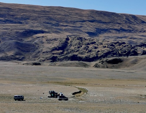
Data acquisition in the area of the 2003 Chuya earthquake seismic rupture
Based on the results of field studies, the researchers built digital elevation models and geoelectric patterns of active fault zones, to determine geophysical parameters, which allowed unambiguous identification of faults against the background of sediments and rocks with different resistivity, including in permafrost areas. Scientists inferred the detected low resistivity anomalies as fault zones and estimated the magnitudes of deep time earthquakes that caused surface ruptures on the day surface which feature the Primorsky fault zone caused by the earthquake with magnitude Мw = 6.9–7.1.
Interesting results were also obtained from investigations of paleoearthquakes in the Kubadru fault zone (Altai). According to scientists, the deep time seismic events were accompanied by release of high-pressure interlayer water onto the surface. The same pattern was observed during the 2003 Chuya earthquake.
Thus, integrated studies of geologists and geophysicists have shown to be highly effective for identification of active faults both on the day surface and at depths of up to the first hundred meters in permafrost strata. The information obtained during the research will help delineate active fault zones and in searches for their buried segments in permafrost areas characteristic of seismically active high-mountain and Arctic regions of Russia.
– These data will contribute to the analysis of seismic hazard and seismicity patterns of the areas of active economic development, - concluded experts form IPGG SB RAS.
For more detail, please, see the article by E.V. Deev, V.V. Olenchenko, A.A. Duchkov, A.A. Zaplavnova, O.V. Safronov: http://www.ipgg.sbras.ru/ru/science/publications/publ-geoelectric-patterns-of-active-faults-in-5630643-2025
Published by IPGG Press Service
Photo courtesy of the researchers